Tuesday, October 18, 2011

GIS and Emergency Response - The Human Side

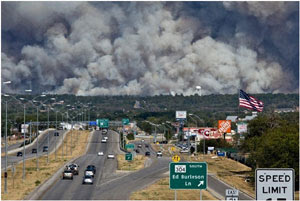
Jason Braunstein, GIS Manager for the Virginia Department of Forestry, recently wrote about the human side of being involved in emergency response as a GIS professional. In his case it was the recent wildfires in Texas. Read his personal account in Forestry's newsletter. It can be hard work and long hours, but Jason eloquently explains why it is worth it.


Tuesday, September 6, 2011

What's In A Map?

Officials at the Washington DC Metro system are updating their Metro Map for the first time in 36 years.  The map has become a well known symbol and reference - love it or hate it - for anyone traveling on the Metro subway system in the DC area.  The Washington Post has an article about what one can expect from the new map and also how they are seeking input to possible changes.

Cartographers will recognize some of the same decision points that go into making any map, such as what colors and symbology to utilize.  In many ways the Metro map is the face of the city and choosing colors that send a "welcome" message to visitors is important to Lance Wyman, the graphic designer who is redesigning his original map from 1976.  You can view the draft map and take an online survey to offer your perspective on the color and symbol choices.

And I am happy to report that there still is a North Arrow and a legend on the map!

Friday, July 1, 2011

Online Broadband Availability Map

The Governor's Office has published a press release about the new Virginia interactive Broadband Availability map, which can be accessed through Wired Virginia.  The mapping effort is a collaboration led by Deputy Secretary of Technology Karen Jackson and includes VITA's Virginia Geographic Information Network, Virginia Tech's Center for Geospatial Information Technology, and the Center for Innovative Technology.

The broadband map data represents the most current and comprehensive statewide view of broadband availability in Virginia.  Data is updated twice a year, spring and fall, to the National Telecommunications Information Agency..  The online map will also be updated after each federal submittal is completed.  The mapping application has some cool GIS features in it as well, including the ability to toggle between the VBMP statewide ortho and the ESRI base map, and ArcGIS Server web services for all data, and the geocoding web service for address look up.  If you haven't seen it yet give it a spin!
Tuesday, May 3, 2011

ESRI Makes Landsat GLS Archive Available as Image Services

ESRI has gone live with its Landsat Imagery services based upon the USGS/NASA Global Land survey (GLS) .

ESRI is publishing the 1975, 1990, 2000 and 2005 GLS datasets as image services that can be accessed in ArcGIS Dekstop, ArcGIS Online and in REST-based web applications. It has also made these services available in web viewers.

The datasets themselves can be viewed in various band combinations. ESRI has also provided a set of change products (GLSChange) than can be accessed just like the Landsat GLS imagery. The GLS and GLSChange services together provide an impressive data resource.

It is worth noting that the GLS datasets do not contain all available Landsat imagery but are global collections of selected high-quality scenes, more or less centered around the nominal year.

Thursday, April 7, 2011

Best Practices for Local Government Geospatial Programs from NGAC

The National Geospatial Advisory Committee (NGAC) has issued a two-page best practices paper that lists four steps to building a successful local government GIS program:
  1. Establish a geospatial program (including recommendations on planning and governance)
  2. Develop and maintain data as an asset
  3. Take an enterprise approach
  4. Share with the public
This might serve as a good resource to assess your local government program and to justify its role or advocate its expansion.


Thursday, March 10, 2011

VBMP 2011 Update -March 10

Sanborn was able to fly the Northern Virginia area this week, as some additional western areas, bringing the acquisition progress up to 47%
Communities flown at higher resolution this week include Arlington, Fairfax City, Lexington, Lynchburg, parts of Salem, Roanoke City, and Roanoke County.

Friday, March 4, 2011

VBMP 2011 Update – March 4, 2011

Sanborn has made good progress in acquiring the 2011 VBMP imagery, with over 15,800 images (38% of the total) now “in the can”. The Richmond and Virginia Beach areas are completed as is the West Block 4 (Roanoke, Lexington, Covington, Bedford Lynchburg, and Danville areas). Also some upgrades areas have been flown (Arlington, Fairfax, Hopewell, Powhatan, Lexington, Roanoke).

Friday, February 11, 2011

VBMP 2011 Orthophotography Flights Begin

Sanborn, under contract with VGIN, has started flying missions to acquire high-resolution digital imagery for Virginia. The 2011 Virginia Base Map Program was scheduled to acquire only the western half of the state, but funding from the U.S. Geological Survey and the National Geospatial-Intelligence Agency, allowed us to extend the area to include the urban areas of Northern Virginia, Richmond, and Virginia Beach-Norfolk-Hampton Roads. Thirty (30) local governments are leveraging the effort with resolution upgrades or area extensions. Flights for the Richmond area started today with the Virginia Beach area scheduled next.

Friday, January 28, 2011

GIS Professional (GISP) Certification - Proposed Changes to Certification


The GIS Certification Institute (GISCI) has an open comment period for proposed changes to GISP certification requirements, most notably the inclusion of an examination.

Note:  First heard on the NSGIC News Blog

Comment period is open February 1 - 28, 2011.

Press Release

Proposal

Monday, January 24, 2011

2010 US Census GIS Data Available for Download

The 2010 US Census TIGER/line shapefiles are now available for download - click here to download.
Data sets are both "state based" and "county based".  Be sure to read about the data sets so you understand what you are getting, as this data can be complicated at times.

Tuesday, January 18, 2011

New Place Name Commemorates Roanoke Physician

The U.S. Board on Geographic Names was created in 1890 to maintain uniform geographic place names. New place names can be proposed and after public review may be approved if certain criteria are met. On January 13th a new name was approved for Virginia. Hutcheson Ridge in Rockbridge County commemorates Dr. Robert S. Hutcheson, Jr. (1919-2003), a Lexington native and noted Roanoke physician. The 3,070 foot high, 1.2 mile long ridge is located at the southern end of Little North Mountain, on the north side of Goshen Pass.